Rivers Manifesto
Healthy waterways are central to Los Angeles’ ability to adapt and thrive in the face of climate change. To ensure a just, equitable, resilient, and regenerative region, our planning and land management approach must quickly pivot to proactive watershed-based actions.
Living rivers present the greatest potential solutions for our climate challenges. Waterways and other wetland systems are essential for resilience: they regulate local water cycles, clean and infiltrate more water for supply, cleanse more air, sequester more greenhouse gasses, and support more species than any other land type in the Los Angeles Region. They are central to coexistence with an intense fire-flood-erosion cycle. They provide opportunities for recreation, and support livable, equitable communities and economies. However, today less than 5% of these resources remain across the region.
Los Angeles is located within a biodiversity hotspot, notable for the diversity of life and the threats faced as a result of our development and land mismanagement. Our region has dramatically changed in the course of its relatively short modern history. What were once expansive grasslands and wetlands became ranch lands and the largest agriculture production in the country.
Over the course of the 20th century, we paved, piped, and graded urban areas to drain precious water to the ocean as quickly as possible. However, concrete-lined channels are neither cost-effective nor safe: they deprive us of local water supplies, increase temperatures and pollutants loads, and ultimately aggravate flood risk.
In fact, the USGS projects that a large flood event like the storms of 1861-1862 is as likely to occur as the biggest possible earthquake, and would result in three times the damage (estimated $725 billion across California). Hundreds of thousands of parcels of land are already threatened across the region. We cannot continue to build within recharge zones and increase flood risk.
The LA River watershed has not had an analysis of flood risk in more than 30 years. Those earlier analyses did not account for climate change. Comprehensive contemporary flood mapping—accounting for current and future land use, including all tributary inputs, projecting for a wide range of potential storm events, and incorporating the latest climate data—is critical for Angelenos to be able to prepare and plan for a safe future.
The health of a watershed and the safety its inhabitants are directly linked to its amount of impervious cover. Minimizing impermeable surfaces and maximizing healthy soil and native plant cover are the most low-impact, cost-effective ways to support habitat, sequester carbon, filter pollutants, cool communities, and increase local water supply. Much of the county has soil infiltration rates of several to even dozens of inches an hour, and most of the county has the benefit of underlying groundwater basins. This is storage infrastructure that is highly effective and already exists today.
We must focus on strategically unpaving our region, moving communities out of harm’s way, and maximizing vital riparian and wetland resources to support healthy, connected ecosystems.
“We can require ourselves to be accountable to our grandchildren and to their great-grandchildren. By making the right choices now, we can promise them bright streams and lasting forests and rewarding employment and welcoming communities.”
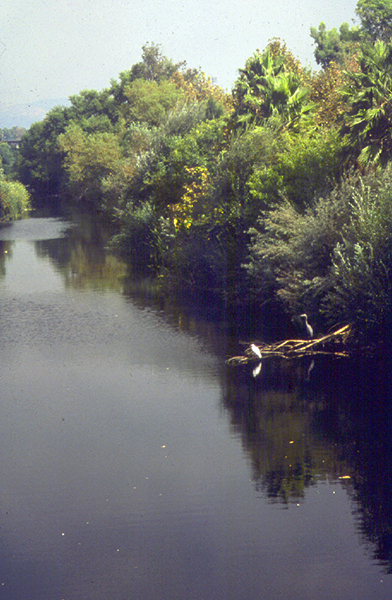

Photo: Lynne Plambeck
We envision a Los Angeles connected by vital riparian woodlands along meandering perennial and ephemeral streams which cool communities, support habitat, clean and infiltrate stormwater, and sequester carbon. The riverfront will be a connective network of open spaces and trails, cultural resources, and recreational opportunities. Communities will live safely outside of the floodplain, and be resilient to extreme heat and storm events thanks to native landscapes supported by healthy soil. Angelenos will grow much of their own food, and water will be sourced locally. Residents of all ages and backgrounds will have access to green jobs that support the region’s resilience. Watershed education will be an integral part of public school education in Los Angeles, fostering generations of stewards.
To realize a just and resilient future we promote the following actions:
Low-Impact River Projects
Ensure all projects along the river use materials that are carbon negative, permeable, simple, and adaptable for incorporating into more comprehensive restoration work into the future. This includes adjacent land acquisition, unpaving, building healthy soil, planting locally native plants, and identifying socially productive interim uses for flood-prone areas. Hardscapes within and along the river increase flood impacts locally and downstream, and are difficult to unbuild. Restricting new development in the floodplain is essential to start saving people and property now.
Floodplain Reclamation
Establish a pool of funding and first option to purchase properties sold in the 500-year floodplain, with priority for the upper watershed down, to maximize project benefits and minimize flood impacts that aggregate downstream. The Los Angeles Basin Study for Conservation, by the US Bureau of Reclamation and LA County Flood Control District, recognizes actions for floodplain reclamation—even considering total costs and complexity—are effective and cost-effective measures for numerous benefits evaluated.
Flood Risk Mapping and Community Engagement
Undertake a comprehensive contemporary analysis of flood risk—accounting for current and future land use, including all tributary inputs, projecting for a wide range of potential storm events, and incorporating the latest climate data. Simultaneously invest in meaningful conversations for actionable outcomes with residents, community leaders, and property owners about risks, opportunities, and preferred just and equitable courses of action for planned adaptation in climate vulnerable areas. Studies show that successful programs are those shaped by residents facing risk.
Residential and Business Retrofit Programs
Simple retrofits of existing properties are among the most cost-effective measures to address regional challenges. Across incorporated LA County residential areas account for 60% of total land area, where billions are already spent on landscape management. With assistance and incentives these investments can be spent instead on simple retrofits to capture, conserve, and reuse water, with soil and plants that sequester carbon, cleanse air, provide cooling, habitat, local food production, public wellness, and sustainable green job opportunities—rather than on the water insecurity, air pollution, and water pollution of conventional yard irrigation, mowing, blowing, and fertilizing. Nearly 25% of total land area is dedicated to roads (140 square miles) and parking (200 square miles)— areas that can also be adapted to create needed park space, provide shade, and manage stormwater while supporting more efficient transportation infrastructure. Over time these projects can collectively reduce peak flow, reducing the size and extent of areas necessary to restore and reanimate our streams, creeks, and rivers.
Public Land Conservation and Stewardship
Protect and conserve land, especially in the upper watershed where the impacts aggregate downstream. The San Gabriel Mountains were originally protected as water resources, and today the region enjoys the protection and conservation of mountains, foothills, and other public lands that provide the majority of our local water. They are also natural treasures supporting diverse life, beauty, inspiration, and endless regenerative services: cleaning air, helping to cool our region, providing outdoor access and recreation, community wellbeing, and driving forces in our local economies. The original Olmstead Plan called for these protections that would have saved us from many of the fire, flood, and erosion movement impacts that are becoming increasingly unaffordable for our region.
Climate-Safe Zoning
General Plans set priorities for land use through zoning. Many of our most climate vulnerable areas are also areas where natural open space would be the highest and best use. All our flood-vulnerable historic waterways can serve instead as recharge zones that provide connective open spaces and critical safety buffers to residential zones. The fire-vulnerable wildland-urban interface and forested upper watershed can become structure-free over time and serve instead as carbon-capturing, habitat-supporting parkland. Proactive planning for coastal areas subject to future sea level rise can avoid destabilizing post-disaster market adjustments that could impact the wider economy.
The National Institute of Building Sciences 2017 study evaluated 23 years of federally funded mitigation grants and found that the nation can save $6 in future disaster costs for every $1 spent on hazard mitigation. As an example, while the Dutch government in recent time spends on average $1.3 billion a year on flood management, they have spent $0 for flood damages since 1953. NOAA estimates that climate-related disasters cost the US $306 billion in 2017 alone.
The realities of climate change demand a new urban paradigm. With knowledge, perspective, and resolve, we can regenerate our landscapes in partnership with nature, setting an equitable path for ourselves and future generations. We must take action now to prepare communities for a changing climate, and waterways must be at the heart of our efforts. Instead of mobilizing in reaction to terrible disasters, as we have in the past, we must provide support for communities to shift organically--through ongoing engagement, planning, and programs that prioritize frontline communities. It’s time to peel back the concrete to enable all of the irreplaceable functions rivers and wetland systems can provide.